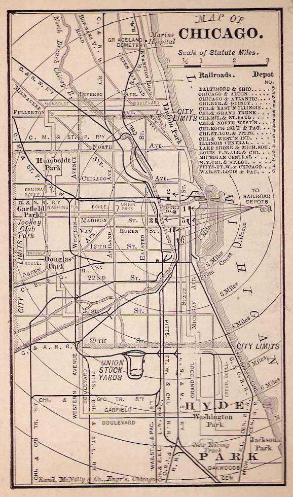
MORE MAPS Use your BACK button to return to this page Chicago image base at the
University of Illinois at Chicago, where you'll find Rand McNally 3-D
maps of Chicago, 1893
Use your BACK button
to return here http://tigger.uic.edu/depts/ahaa/imagebase/ Chicago Landmarks - Maps of different sections of the city http://www.ci.chi.il.us/Landmarks/Maps/Maps.html Interactive Chicago Neighborhood Maps http://rubloff.com/inside/maps_list.html "The Plan of Chicago", 1909 http://www.encyclopedia.chicagohistory.org/pages/10537.html |